1. POLAND – railway map (B1 format)
Scale: 1:960 000
Size: 98 x 67,2 cm, folded 14 x 22,4 cm
ISBN: 978-83-927160-1-3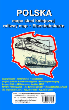
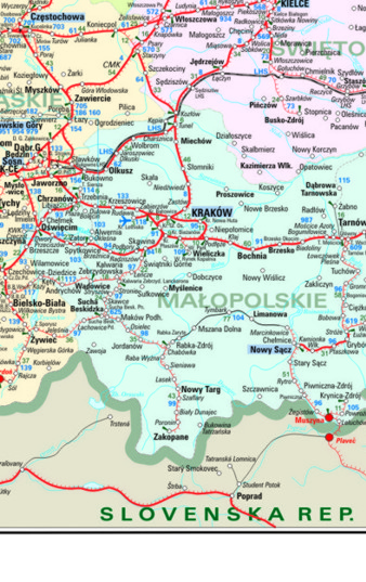
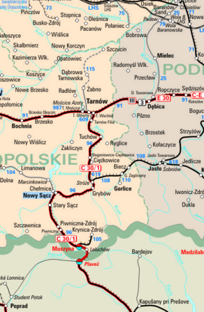
The map depicts the railway communication network in Poland divided into several parts: double-tracks, single- tracks, narrow gauge and broad gauge lines, tracks out of use. The map shows also electrified lines, tariff distances and PKP PLK line numbering. The names of border towns have been clearly marked. The map reproduces hydrography and border lines of the Polish states.
On eight sheets - the railway routes of the main rail hubs: Warsaw, North Silesia, Szczecin, Gdansk, Poznan, Wroclaw, Lodz, Krakow.
The legend is in Polish, English and German.
The map shall be an excellent medium for logistic companies advertisements.
We produce two versions: a wall and a folded map.
A wall map is laminated on the both sides and framed.
On the back side of the map you will find a map of the European railway communication network.
2. POLAND – railway map (B1 format)
Scale: 1:960 000
Size: 98 x 67,2 cm, folded 14 x 22,4 cm
ISBN-10: 83-907810-2-6
ISBN-13: 978-83-907810-2-0
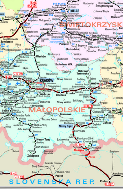
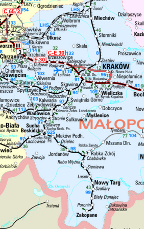
The map depicts the railway communication network in Poland, the map is divided into several parts: main lines (EIP, EIC, EC, EN, TLK, IR IC, EC, EX), secondary lines (R, Os-regional trains), suspended passenger traffic lines, narrow gauge and broad gauge lines, tracks out of use. The map shows also electrified lines, tariff distances and PKP PLK line numbering, AGC, AGTC lines, OSJD Corridors, Pan-European Corridors. The names of the border towns and the types of border crossing points: passangers, freight and both passenger and freight are clearly marked. The map reproduces hydrography and border lines of the Polish states including their names and colour-filled marking.
The railway routes of the main rail hubs have been traced on the eight sheets: Warsaw, North Silesia, Szczecin, Gdansk, Poznan, Wroclaw, Lodz, Krakow.
The map legend is in Polish, English and German.
The map shall be an excellent medium for logistic companies advertisements.
We produce two versions: a wall and a folded map.
On the back side of the map you will find a map of the European railway communication network.
3. POLAND – railway map (B2 format)
Size: 61,8 x 47,4 cm
Folded: 10,3 x 15,8 cm
The format B2 of the map is a resized version of the map at a scale 1:960 000. It depicts the identical area.
The map shall be an excellent medium for logistic companies advertisements. Available folded version.
On the back side of the map you will find a map of the European railway communication network.
4. POLAND – railway map (wall map, B0 format, laminated and framed with PVC frames)
Size: 141 x 114 cm
ISBN: 978-83-927160-1-3
The wall map depicts the railway communication network in Poland divided into several parts: double tracks, single tracks, narrow gauge and broad gauge lines, tracks out of use. The map shows also electrified lines, tariff distances and PKP PLK line numbering. The names of border towns have been clearly marked. The map reproduces hydrography and border lines of the Polish states.
On eight sheets - the railway routes of the main rail hubs: Warsaw, North Silesia, Szczecin, Gdansk, Poznan, Wroclaw, Lodz, Krakow.
The legend is in Polish, English and German.
The map shall be an excellent medium for logistic companies advertisements.
5. POLAND – railway map (wall map, B0 format, laminated, framed with PCV frames)
Size: 141 x 114 cm
ISBN-10: 83-907810-2-6
ISBN-13: 978-83-907810-2-0
The map depicts the railway communication network in Poland, the map is divided into several parts: main lines (EIP, EIC, EC, EN, TLK, IR IC, EC, EX), secondary lines (R, Os-regional trains), suspended passenger traffic lines, narrow gauge and broad gauge lines, tracks out of use. The map shows also electrified lines, tariff distances and PKP PLK line numbering, AGC, AGTC lines, OSJD Corridors, Pan-European Corridors. The names of the border towns and the types of border crossing points: passangers, freight and both passenger and freight are clearly marked. The map reproduces hydrography and border lines of the Polish states including their names and colour-filled marking.
The railway routes of the main rail hubs have been traced on the eight sheets: Warsaw, North Silesia, Szczecin, Gdansk, Poznan, Wroclaw, Lodz, Krakow.
The map legend is in Polish, English and German.
The map shall be an excellent medium for logistic companies advertisements.
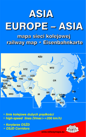
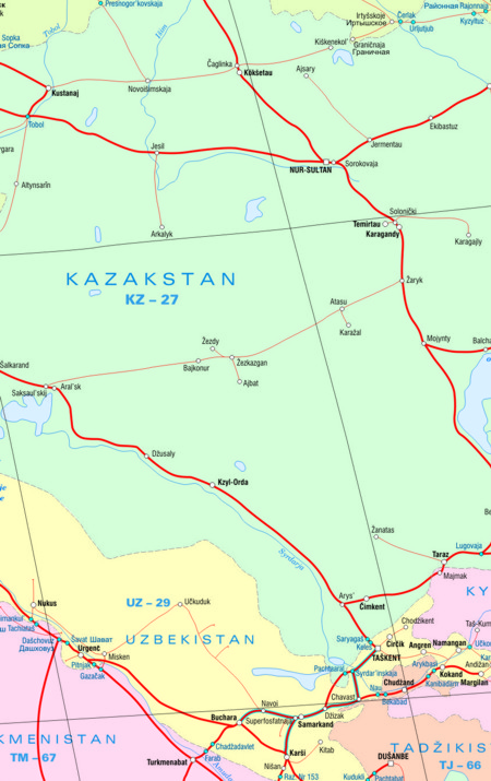
6. EUROPE - ASIA – railway map (large wall map, laminated)
Size: 195 x 138 cm
ISBN-13: 978-83-911667-8-9
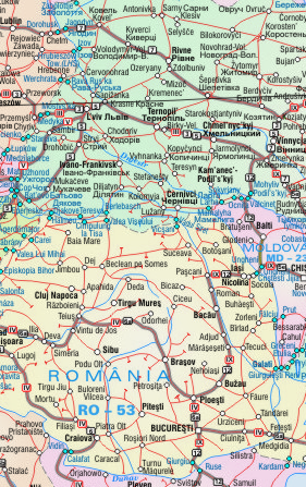
The only available in Europe wall map with color marked countries’ borders and area, European and Asian railway communication network divided into main and secondary lines and train-ferry links. The high-speed lines, OSJD Corridors, Pan-European Corridors are depicted. UIC - country code also included. The border crossing points clearly visible.
In the area of Russia, Ukraine and Belarus all the names have double description both in cyrillic and latinic transcription.
The map covers the area from Portugal to Kazakhstan.
The sheet sized 86 x 49 cm shows the area from Moscow to Japan in the East and to Saudi Arabia, India and Vietnam in the South.
The map legend in Polish, English, German and Russian.
This map became very popular among logistic companies and it is an excellent medium for logistic companies advertisements.
Since usefulness and pleasing look this map is very often used as a decorative element in offices.
7. EUROPE - railway map (B1 format)
Size: 98 x 67,2 cm, folded: 14 x 22,4 cm
ISBN-10: 83-907810-7-7
ISBN-13: 978-83-907810-7-5
The map includes clearly color marked countries’ borders and area, European railway communication network divided into main and secondary lines and train-ferry links.
The high-speed lines, AGC and AGTC lines and UIC - country code are also depicted. The border crossing points clearly visible.
In the area of Russia, Ukraine and Belarus all the names have double description both in cyrillic and latinic transcription.
The map legend is in Polish, English, German and Russian.
The map shall be an excellent medium for logistic companies advertisements.
We produce two versions: a wall and a folded map.
A wall map is laminated on the both sides and framed.
On the back side of the map you will find a map of the Polish railway communication network at a scale 1:960 000.
8. EUROPE – railway map (B2 format)
Size: 61,8 x 47,4 cm
Folded: 10,3 x 15,8 cm 
The format B2 of the map is a resized version of the map of the European railway connection network at a size B1 . It depicts the identical area.
The map shall be an excellent medium for logistic companies advertisements. On the back side of the map you will find a map of the Polish railway communication network.
9. EUROPE – railway map (wall map, B0 format, laminated and framed with PVC frames)
Size: 137 x 96 cm
ISBN: 978-83-907810-7-5

The wall map includes clearly color marked countries’ borders and area, European railway communication network divided into main and secondary lines and train-ferry links.
The high-speed lines, AGC and AGTC lines and UIC - country code are also depicted. The border crossing points clearly visible.
In the area of Russia, Ukraine and Belarus all the names have double description both in cyrillic and latinic transcription.
The map legend is in Polish, English, German and Russian.
The map shall be an excellent medium for logistic companies advertisements.
10. EUROPE – ASIA – railway map (wall map, B0 format, laminated, framed with PCV frames)
Size: 134,2 x 94,4 cm
ISBN-10: 83-911667-8-3
ISBN-13: 978-83-911667-8-9

The only available in Europe wall map with color marked countries’ borders and area, European and Asian railway communication network divided into main and secondary lines and train-ferry links. The high-speed lines, OSJD Corridors, Pan-European Corridors are depicted. UIC - country code also included. The border crossing points clearly visible.
In the area of Russia, Ukraine and Belarus all the names have double description both in cyrillic and latinic transcription.
The map covers the area from Portugal to Kazakhstan.
The sheet sized 59 x 34 cm shows the area from Moscow to Japan in the East and to Saudi Arabia, India and Vietnam in the South.
The map legend in Polish, English, German and Russian.
This map became very popular among logistic companies and it is an excellent medium for logistic companies advertisements.
Since usefulness and pleasing look this map is very often used as a decorative element in offices.
11. EUROPE – ASIA – railway map (B1 format)
Size: 98 x 67,2 cm, folded: 14 x 22,4 cm
ISBN-10: 83-907810-8-5
ISBN-13: 978-83-907810-8-2
The map includes clearly color marked countries’ borders and area, European and Asian railway communication network divided into main and secondary lines and train-ferry links.
The high-speed lines are also depicted. UIC - country code also included. The border crossing points clearly visible.
In the area of Russia, Ukraine and Belarus all the names have double description both in cyrillic and latinic transcription.
The map covers the area from Portugal to Kazakhstan.
The sheet sized 42 x 24 cm shows the area from Moscow to Japan in the East and to Saudi Arabia, India and Vietnam in the South.
The map legend in Polish, English, German and Russian.
This map became very popular among logistic companies and it is an excellent medium for their advertisements.
We produce two versions: a wall and a folded map.
A wall map is laminated on the both sides and framed.
On the back side of the map you will find a map of the Asian railway communication network (from Moscow to Japan).
12. ASIA – railway map (B1 format)
Size: 98 x 67,2 cm, folded: 14 x 22,4 cm
ISBN-10: 83-911667-9-1
ISBN-13: 978-83-911667-9-6
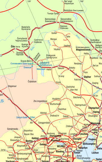
The map includes clearly color marked countries’ borders and area, Asian railway communication network divided into main and secondary lines and train-ferry links.
The high-speed lines, OSJD Corridors, Pan-European Corridors are also depicted. UIC - country code also included. The border crossing points clearly visible.
In the area of Russia, Ukraine and Belarus all the names have double description both in cyrillic and latinic transcription.
The legend of the map in Polish, English, German and Russian.
This map became very popular among logistic companies and it is an excellent medium for logistic companies advertisements.
We produce two versions: a wall and a folded map.
A wall map is laminated on the both sides and framed.
On the back side of the map you will find a map of the Europe - Asia railway communication network.
13. GERMANY – railway map (wall map, B0 format, laminated and framed with PVC frames)
Size: 104 x 129 cm
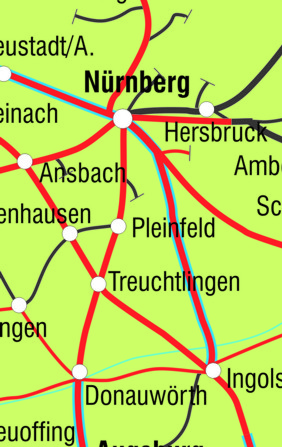
The map presents the German rail network divided into: single-track and double-track lines, high-speed lines and train-ferry links. Electrified lines are also marked on the map. The border crossing points clearly visible. Legend in Polish and English.
14. UKRAINE – railway map (wall map, laminated)
Size: 72 x 52 cm
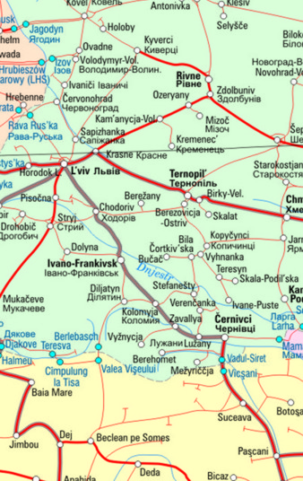
The map presents the Ukraine rail network divided into main and secondary lines, AGC and AGTC lines. The border crossing points clearly visible.
In the area of Ukraine all the names have double description both in cyrillic and latinic transcription. The map legend is in Polish, English, German and Russian.
15. EURASIA - railway map (B1 format)
Sheet: 98 x 67.2 cm, folded 14 x 22.4 cm
ISBN: 978-83-927160-4-4
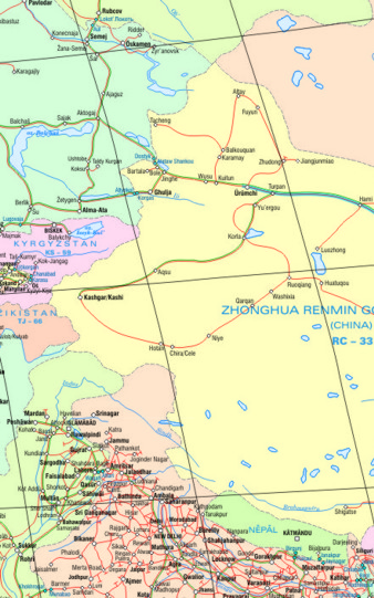
A unique cartographic study showing on one page and at the same scale the layout of the railway network in Europe and Asia, from Portugal to Japan in the east, and Saudi Arabia, India and Vietnam in the south. Main and secondary railway lines, high-speed lines and railway ferry connections are marked. The names of border stations are clearly displayed and the UIC - country code is placed. In addition, the route of Trans-Asian railway lines is marked in green on the basis of: UN/ESCAP - list of lines. Legend in Polish, English, German, Russian and Chinese. Due to the scope of content and the presentation on one page and on the same scale of all possible routes of the New Silk Road corridors, the map is appreciated by forwarding companies and is an excellent medium for their advertising. It is available in both wall and folded versions. Wall version laminated on both sides and framed with slats. On the reverse side of the folding map, there is a map of the Europe-Asia railway network.
...